The Gifford House is right beside the campground. And you know what gets delivered at 8:00 a.m. every morning? Fresh baked cinnamon rolls and pies!
 |
| Get there early before they sell out! |
 |
| Homemade pies! |
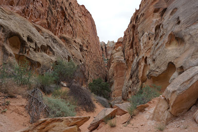
What a way to start off this great break of 4 days off! Wake up and go hike! The Cohab Canyon trailhead is right by the campground so away we go! It is a little bit over a 3 mile hike with switchbacks of about a 440' elevation change. At the top of the switchbacks, the hike takes you into hidden canyons with views of Fruita from the top and wonderful panoramas. This trail will take you all the way over to Hwy. 24, but we didn't do that option.
 |
| You can see our trailer from up above! |
 |
| There's a view of historic Fruita. |
 |
| This is for my cousin Nell's hubby who likes to stack rocks. This stack is a little overdone, but there were lots around! |
The switchbacks end abruptly at the edge of a flat, grassy bench below the looming Wingate cliff. Down deep in the gorge westward are the oldest rocks exposed in Capitol Reef, the White Rim Sandstone and Kaibab Limestone. The entrance into Cohab Canyon is pretty breathtaking. There are a couple of slot canyons to explore.
 |
| Walking in Cohab Canyon |
 |
| Nice trail once you got past all the switchbacks. |
 |
| Ron in one of the slot canyons. |
 |
| Amazing how these trees can grow. |
We took the steep switchbacks to the viewpoints that allowed us to see Sulphur Creek to the Visitor Center and also the Scenic Drive and highway 24. Amazing!
 |
| One of my favorite shots. |
 |
| Looking a long ways down! |
 |
| Hwy. 24 as seen from up above. |
 |
| Fremont River and Hwy. 24 |
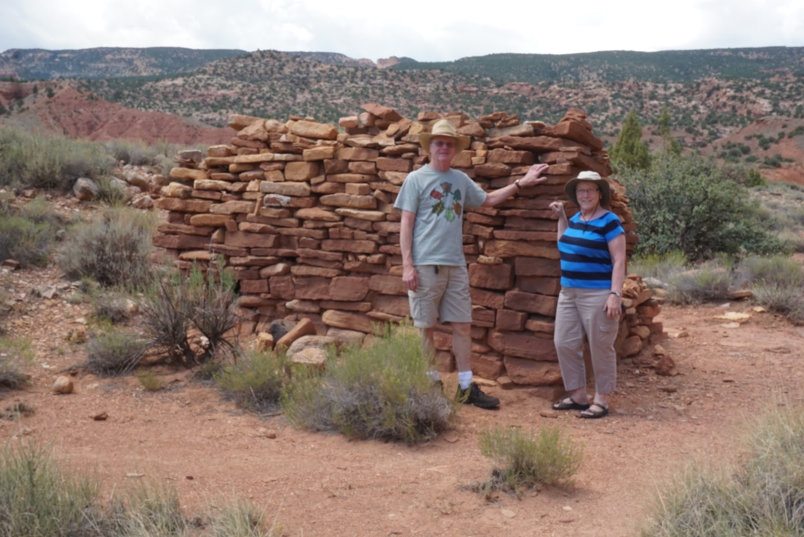
I have mentioned before and I am sure I will again, but the best thing about volunteering is the like minded folks you end up meeting. We met Jim and Randa back at LBJ National Historical Park. They finished up their volunteer gig at Lake Tahoe and on their way to Minnesota, they swung by to visit us. What a treat! They are such great folks and so knowledgeable about the rocks and plants out here. We always learn something from them! We drove back down with them on the Scenic Loop, got out and did a little walking. Two things we had missed on our previous hike: petroglyphs and a better wall for the Pioneer Wall viewing.
 |
| Jim and Randa and Quam. Very special folks! |
 |
| Found this fixer upper by the mines. |
 |
| Missed these petroglyphs earlier |
 |
| Still wondering how those pioneers got this high up to carve their names. |
We took a drive up to Fish Lake National Forest to check it out. We are interested in fishing and also camping up here on our days off. It was a beautiful drive out. The Fremont River headwaters are here and in the national forest on the BLM land, you can pretty much find a spot to pitch a tent. Fish Lake is the largest natural mountain lake in Utah.
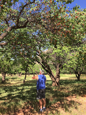 |
| Picking apricots for our friends. |
 |
| And then some apples. |
 |
| Johnson Reservoir, right by Fish Lake. |
 |
| Old Santa Fe Trail |
 |
| Fish Lake |
 |
| Learning about the Santa Fe Trail |
 |
| The headwaters of the Fremont River come out of Johnson Reservoir. |
As we said good-bye to the Weber's, I had a really great treat from a classmate from Sweeny High! Darla Finley Nightingale was visiting the park with family and took the time from their schedule to stop in and say hi. So great to see her, did a little catch up. Funny how all these years later, we are still the same people. :).
 |
| Darla and Mary, SHS Class of '76!! |
Our adventure of this day was going to be driving the Nottom-Bullfrog Road loop that takes you out of Capitol Reef, back into the park, then out and over the Grand Staircase Escalante National Monument. Wow was this a beautiful drive! (Definitely don't do if it is raining though.). The road can actually take you down to Lake Powell. This was a 128 mile loop. Our first view is of The Muffins on top of the fold. Then we drive down and cross Pleasant Creek, one of 4 streams that flow through Capitol Reef.
 |
| The Muffins |
 |
| Pleasant Creek |
Then we see a surprise of irrigated fields on the privately owned Nottom Ranch. Look at the white picket fence enclosure. This is a gravesite for a son of one of the pioneers. He fell from his horse herding sheep and died from internal injuries. You will get awesome views of the Henry Mountains.
 |
| These irrigated fields take you by surprise. |
 |
| Picket fence grave site |
We passed some hoodoos as we travel on through Cottonwood Wash. Then there's a place called Sandy Ranch Junction and the last perennial stream that crosses into the park is Oak Creek. Irrigated alfalfa fields. We cross back into the park.
We drive along Oyster Shell Reef where you can see large fossilized oysters. We come to a junction and head right for Boulder and Escalante. As we head toward the ridge there are 6 switchbacks and we climb really high. It is pretty cool to look down and see where we came from!! The road continues through the Wingate Sandstone offering some pretty scenery. And finally when we cross into the Grand Staircase Escalante National Monument, the road becomes paved. This part of the drive takes us down beautiful, red Long Canyon to the Gulch and then climbs the Navajo. We were dodging rain showers which changed up some of the colors I am sure, but was still so pretty.
 |
| Taking a stretch |
 |
| Cool road, awesome views |
 |
| It was crazy how these rocks were just strewn around. |
 |
| Looking down the steep climb we just took. |
We come into Boulder and make a pit stop at the State Park and guess who we run into again! Darla and her family! So we are back on Highway 12, which was the drive we made with the RV on our way down and was pretty scary driving. Much better to look at a the scenery now. We made a couple of stops, primarily at Lower Bowns reservoir to check out camp sites.
Another great road trip! And so many more left to travel!


No comments:
Post a Comment