Jeep

Jeep

Monday, April 8, 2024

Death Valley National Park


This post is all about Death Valley National Park, located in the desert in California. I don’t know about you, but when I think of Death Valley, it’s my childhood memories.  Hot as hell. Mormons died in the 1800s because the only water they found was salty and no one or no other animals would drink. I remember watching western tv shows about it.


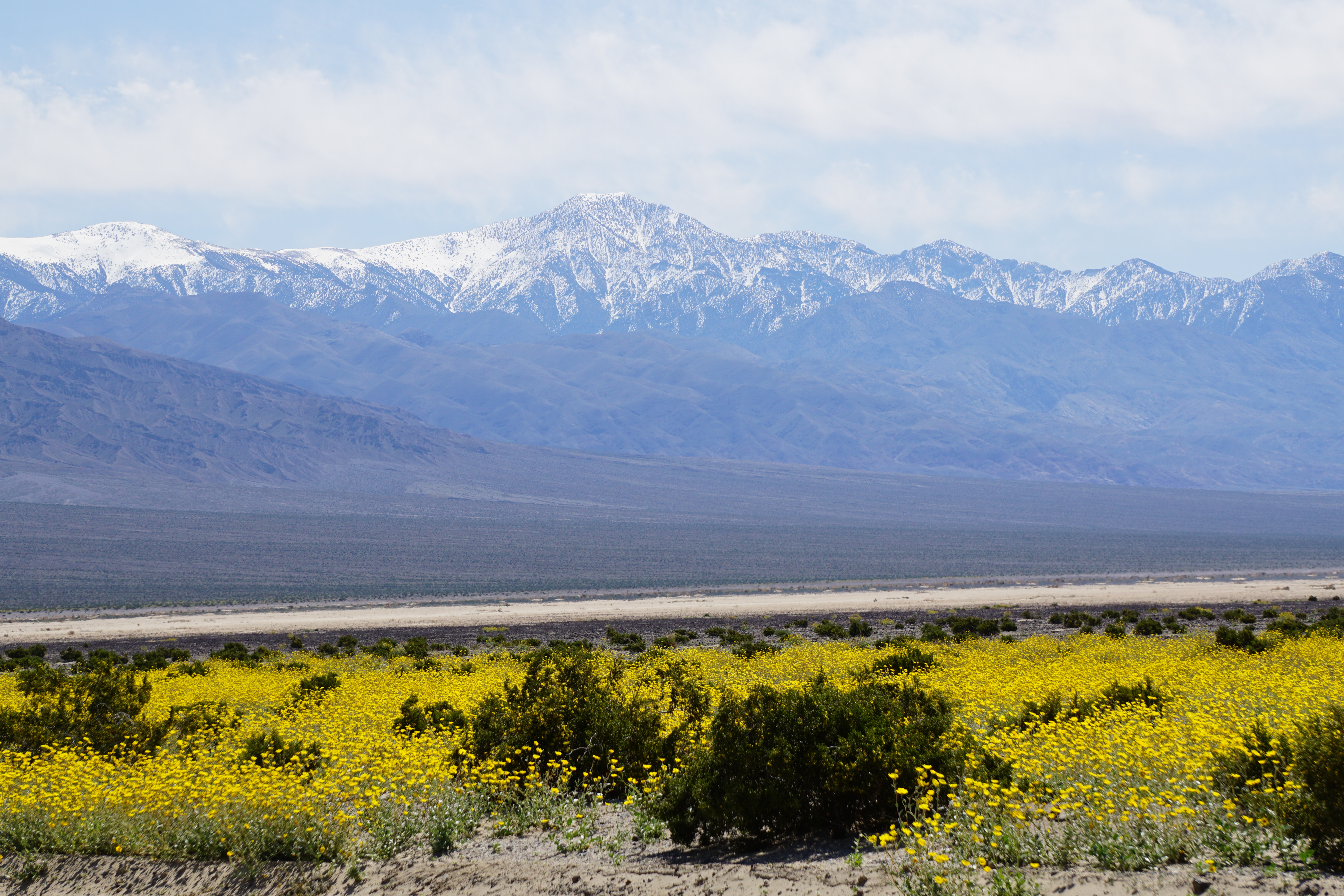
But…..if you come in the spring it’s a whole different story!  We planned our launch date for this trip around getting here in hopes of a super bloom or at least wildflowers.  Well, sorry to say no super bloom.  But there are many wildflowers to view.


Near Pannamint Canyon

Here’s some history.  Death Valley National Park was established in 1994, the 53rd park among America’s 59 National Parks.  It straddles eastern California and western Nevada.  Death Valley is known for its colorful rocks and Badwater Basin’s salt flats…which we hiked to. Badwater Basin is the lowest place in North America at 282 feet below sea level.  It’s record temperature is 134 degrees Fahrenheit makes it the hottest place on earth.  Thank goodness we visited in the spring before it got so hot.  The massive salt flat here covers nearly 200 square miles and lies more than two miles below the 11,331 foot Telescope Peak that looms above it. Whew.  But don’t forget about the Mormons that traveled through here, couldn’t find water, and well….you might remember the rest of that story!

So, Day 13, April 5 our destination is Death Valley National Park.  We logged 732 miles driving in Arizona.  On our route here, we travel into California, then Nevada close to Las Vegas, before entering the park back through California.  We got hailed on south of Vegas.  Nothing big or bad.  We got settled into our site (#16) at Furnace Creek which is below sea level.  We have views of snow capped mountains on one side and views of black clouds in the valley and over the mountain on the other side.  It’s cool – upper 50’s (I know you were expecting heat).  It’s beautiful! Not what we expected. We came in hopes of a super bloom but there’s just beautiful patches of flowers.

Hail south of Vegas

View from campsite

Day 14 – April 6

What a beautiful, peaceful place this is. Today it’s clear blue skies. There are flowers – if you walk in the desert. We undocked and took a ride to Badwater Basin that is 282’ below sea level. We made a side drive through Artist Canyon which was well worth it. Then we took a long hike to the Devil’s Golf Course. There’s still water in the lake, which is amazing. The dried salt formations here looked like coral. So cool to see this.  BTW it’s not hot. We have on jeans and long sleeves. We continued our drive which made a long loop back to Furnace Creek. We saw beautiful cactus in bloom. Their hot pink flowers looked fake as we were driving through.


The truck looks small!


Really didn't expect to see so much snow here.

Looking down at Badwater Basin


Some twisting roads!


Pretty patch of yellow daisies


Worth the long hike down to really see and touch!

Wading to the water


These almost looked fake when you're viewing across the land.

Day 15 – April 7, 2024

We’re starting week #3!  We did a drive on the northeast side of the park.  We headed towards Stovepipe Wells Village where the Mesquite Flat Sand Dunes are.

Mesquite Flat Sand Dunes

As we neared Panamint Springs Valley, you could see a carpet or yellow daisies everywhere!  Very pretty!


Fields of yellow flowers

Even taken through the windshield it's pretty


We then drove up to Father Crowley Vista Point that overlooks Rainbow Canyon. We didn’t realize that the Air Force does drills through this valley and canyon.


Rainbow Canyon

You know the song…..”The stars at night are big and bright, deep in the Heart of Texas!” Well the stars here our just absolutely amazing. We left the window open on the hatch above the bed just to continue watching them. Billions of stars look like a pincushion stuffed with pins.

The weather is still good.  Came back and docked the truck and camper to be ready to leave tomorrow for a state park in Nevada.  Our California driving miles totaled 520 miles, mostly just driving through this enormous park.

Death Valley…….so empty, so vast, so simple, so quiet.


Thursday, April 4, 2024

Truckin’ Across Arizona!


Day 8 (March 31) of our trip found us leaving New Mexico after driving 551 miles through it.  We got an early start for two reasons (1) to avoid the wind and (2) to try and beat the rain. Our route had us hitting I-10 for a short distance and there was wind and sandstorms. Once we got off the interstate, it was all much better. And when we crossed into Arizona it was like someone changed the lightbulb – it was beautiful!  There are wildflowers and snow capped mountains. But the crazy time change kinda has us messed up. (Arizona doesn’t observe daylight savings time).

Welcome to Arizona!

We got into Lost Dutchman State Park around 1:00. It’s raining and it’s cold. But it’s breathtaking!  The Superstition Mountains are in our view from the campsite.  I wish we were staying longer, but when I was making reservations, this was all I could find.  We napped while it rained. Then we made Easter dinner and enjoyed our propane campfire.


Superstition Mountains behind our campsite.

Rain can make a picture look so different!

Our campsite. Can't beat that!


The saguaro is massive.

Beautiful "weeds"


Springtime blooms


Rain drops


The birds were out!


Day 9 (April 1) we set our sights on Dead Horse Ranch State Park, south of Sedona, Arizona.  What an interesting and beautiful ride over we had. We listened to the local weather before leaving. They said it hasn’t rained or snowed on Easter since 1989. Well, yesterday it rained. And today while traveling through the high country, it snowed. We traveled highway 260/87, skirting around Phoenix.  


Once we got settled into our campsite, here came the rain. The park is along the Verde River.  The park is 423 acres. In case you wonder how the park was named…..The Ireys family came to Arizona from Minnesota in the late 1940s looking to buy a ranch. At one property they discovered a dead horse by the road. When Mr. Ireys asked the kids which ranch they liked best, they said, “The one with the dead horse.” When Arizona state parks acquired the park in 1973, the condition of the sale was retaining the name.  The park is a good location for day trips to see the beautiful red rock country that Sedona is famous for.  We stayed two days just for this reason, although we had to change campgrounds.

Day 10 (April 2) was our “tourist” day. Our first stop was  Montezuma Castle National Monument. (By the way, keep in mind that if you visit here, get here early.  It’s a very small parking lot and at 10:00 am it was pretty packed.  When we left they were parking up and down the road.) I think it’s always cool to see cliff dwellings.  Southern Sinagua farmers built this five-story, 20 room dwelling sometime between 1100 and 1300 AD. It occupies a cliff recess 100 feet above the valley. Early settlers assumed it was Aztec and therefore the name. The occupants here found water in the creek and fertile soil land to farm. No one knows why the Southern Sinagua migrated away from their pueblos by the early 1400s.  Teddy Roosevelt created this 3rd National Park.

Cute little bird out our window

Montezuma Castle NHP

Beaver Creek by the park - a little swollen from the rains

Next stop, since it was close by, was Fort Verde State Historic Park. This was a frontier soldier fort in Camp Verde, Arizona. The fort was a base for General Crook’s U.S. Army scouts and soldiers in the 1870s and 1880s. There are 3 historic house museums – The Commanding Officer’s Quarters, Bachelor Officer’s Quarters and the Surgeon’s Quarters on Officer Row. 


A view of the Surgeon's House/Hospital and the Bachelor Quarters

Commanding Officer's Quarters where Tonto the Apache Chief and 300 of his men surrendered to Gen. George Crook in 1873.

The last stop of the day was Red Rock State Park. There is no camping here as it is a 286-acre nature preserve and environmental education center. What we enjoyed was the absolutely most stunning scenery!  Hiking trails are abundant. They have a lot of mule deer here as well. We hiked up the Apache Fire Loop to see the Apache Fires House up close.  In 1941 Helen and Jack Frye were looking for a get away place from the pressure’s of Jack’s job as president of Trans World Airlines (TWA). They acquired 5 small homesteads that became the 700 acre Smoke Trail Ranch. Before the home was completed, they divorced.  Helen got the property here.  Construction on the house began in 1947, but stopped with the divorce but Helen moved into the second floor. The park acquired the land in 1991.

Beautiful red rock scenery

Red Rock State Park


Apache Fires House and 3 Sisters


The creek is flowing pretty good after the rain.

Big Tree

All of this being a tourist for a day wears one out. We got to our new campsite to chill, cook a steak, and enjoy life. But our neighbors next door are camping in a Tesla pickup truck and it seems like it’s a magnet for everyone to stop and check it out lol.

The Tesla Pickup Truck. Not for us!

Day 11 and 12 - The last part of our stay in Arizona is Cattail Cove State Park, located on Lake Havasu. This is our second time here and I must say it’s a beautiful, well maintained state park. They have irrigation for the trees and seem to go out of the way to keep it clean.  There’s another “Campground Full” sign out. We didn’t get here until 3:30 and low and behold, they close the office early and they lock the dump station. There are so many boondockers out here off of Hwy 95 that tend to make a mess of it is what we’re told. So…..keep that in mind if you’re traveling here with a pretty full tank that needs to be emptied lol. So let me share something about our drive over here. The GPS put us on Hwy. 89A through Jerome. Oh my gosh it’s a beautiful drive and the town looked like so much fun. We didn’t stop though. It’s a very narrow and winding road, the town is built on “levels” and parking a rig like ours would have been mostly impossible. Don’t even think of driving anything bigger than what we have over this road. But it was one of the prettiest drives we have been on so far. I-40 going west is VERY rough. The stars are absolutely amazing at night! We’re staying here 2 nights enjoying the park.

The park's nature trail. Very nicely done.

The lake water is so clear. It's a little chilly for me!

I love that they have a labyrinth trail here and places to sit and meditate. 

Such pretty water

Next up will be our Death Valley National Park adventure!


Tuesday, April 2, 2024

Truckin' Across New Mexico

 We spent 2 nights in the state of New Mexico. We experience a lot of wind there.

Day 6 – Sumner Lake State Park, New Mexico

What a windy ride!  And…….ta da……..We have made our first state crossing.  It only took us 876 miles from our home in Sweeny, Texas to the New Mexico border at Farwell TX/Texico NM.  Sumner Lake is fed by the Pecos River. The color of the water is beautiful. It’s very windy. Our site (#7) isn’t anything to write home about, but we do have a view of the lake and it’s only $14 a night for water and electricity. We did enjoy our propane firepit and the star gazing!

Sumner Lake NM from our campsite

Sumner Lake NM

Our campsite here


Day 7 – Caballo Lake State Park, New Mexico

The drive here was a long one.  We consider anything over 4 hours long.  But….we were excited to see that our route here would take us through San Antonio, NM. Why were we excited?  Well, the Buckhorn Tavern has the world famous green chili cheeseburger!  We stopped here about 14 years ago after a local recommended it to us.  We have tried several other times to come back and taste the burger.  But it always seemed to be closed.  Today didn’t disappoint!  It’s our lunch (and dinner), and it’s a very welcome break as the winds are topping out over 20 mph on our drive.

Ron telling me to hurry up!

The world famous green chili cheeseburger at Buckhorn Tavern in San Antonio NM

But Caballo Lake State Park didn’t disappoint either. We have a great site (#7, full hookup, $22 night). We’re able to sit out of the wind kinda and view the lake. The lake is fed by the Rio Grande River (which starts in Colorado and winds through the Texas and Mexico border to the gulf. We enjoyed visiting fellow campers and watching a beautiful sunset. 


Scenery while we're traveling

Caballo Lake State Park

Caballo Lake

Ron trying to escape the wind.

Beautiful sunset!

New Mexico was great, but the weather wasn't the best. High winds made it challenging at times to travel. We traveled 551 miles through this state!

Stay tuned for Arizona!