We have had some fun times on our last 2 breaks! Both breaks included fishing, but let me start by telling you about our drive around the Cathedral Valley here at Capitol Reef. We have awesome weather, by the way. Already starting to cool down as the days start getting shorter here. We packed up the tent and chose our route around Cathedral Valley. Now here is a fun fact: The valley offers scenes unlike any other in Capitol Reef National Park, but it is the least traveled due to the roads. Generally a high clearance 2 wheel drive vehicle works and I am glad to say, the big black beast (which is 4WD) made it just fine. The Rangers will encourage any travelers on this road to be prepared because if you have problems, it could be hours or days before anyone might find you. The loop is 58 miles. It literally took us 5 or 6 hours just to drive half-way, which is why we brought the tent.
So hop in the truck with us as we start this awesome adventure! The first thing we have to do is cross the Fremont River Ford. The report says the river here is only 11" deep, so no worries. (Don't try after rain or during a possible flash flood though.). You get on the Hartnet Road which is on private property and drive a ways and all of a sudden the Fremont River appears in front of you and literally you see no exit on the other side. We get out and look and sure enough down to the right you will see an exit on the other side. So in the truck we go, turn right and drive in the river and whoosh! Up the creek bank on the left! Whew! Glad that part of the adventure is done.
 |
| Looks like there is no exit on the other side. |
 |
| Driving down the river |
 |
| Look to the right on the far bank - that is the exit. | | | |
|
|
|
|
|
|
| | The road is now a little sandy and rutted and begins to climb steeply
onto the Salt Wash, which can make for some rough driving. Along the
way, we spot a spring that has a thicket of tamarisk and an old truck.
Fun to get out and look and feel the cold water. |
 |
| Pretty cool water well drilling equipment. |
The Bentonite Hills, which are multi-colored rounded hills, are next up on the feast for our eyes. Now if this stuff gets wet, the clay within this rock layer absorbs water and can get really muddy and sticky. There's a little smoky haze in the sky today, but we can look one direction and see the Henry Mountains, then Thousand Lake Mountain, and the jagged Waterpocket Fold. Just beautiful!
 |
| Kinda looks like icing on a messed up cake. |
On down the road, we take a spur road and then a hike to view Jailhouse Rock, which is where we saw the only vehicle today. This is the Lower South Desert Overlook. It's a really large valley that runs parallel to the Waterpocket Fold. Jailhouse Rock is 500' tall.
 |
| Jailhouse Rock |
 |
| King of the Mountain! |
By the way, Hartnet Rd. Is named for an early trailblazer Dave Hartnet who pioneered this route from Fremont to Caineville in the early 1880's. Ackland Spring is located in Hartnet Draw and provides water for livestock. Ranching has been one of the main occupations of residents in the Capitol Reef area since the first pioneers arrived. They are still one of the few national parks that permit grazing within its boundaries.
The South Desert Overlook hike takes you to the top of a high knoll which overlooks the South Desert. It is soooo quiet here and the scenery is overwhelming. Pictures just don't do it justice.
On down the road is the Upper Cathedral Valley overlook and again, the scenery is just spectacular!
 |
| How cool is this looking down! |
 |
| Debating on whether or not to do some cliff hanging. |
 |
| So serene and so quiet! |
Cathedral Valley Overlook is just as stunning!
 |
| Cathedral of the Sun, Moon and Stars. |
The park has a remote camping area here on the north end and it is really nice. For now, we stop for a mid-afternoon picnic as we want to continue our driving over Polk Creek Road to Thousand Lake Mountain, which is in the Fish Lake Forest. This is a very scenic route with panoramic views of the surrounding painted desert country. It's a steep climb and when we reach a campground over here, it is 9500' elevation and our heads start to hurt. So decided this isn't where we want to set up the tent, even though it is beautiful. So back we go to Cathedral Valley. Have a great spot here and enjoy the quietness and beauty of looking into Cathedral Valley. Got great shots of the Cathedral of the Sun and Moon.
 |
| This is a room with a view! |
 |
| A little smoky haze, but the Henry Mountains are back there. |
 |
| Henry Mountains |
 |
| Sunset looking down Cathedral Valley. That's our road down there. |
 |
| Lawn chair view |
 |
| Wonder how old the cedar is. |
 |
| Great fire, great views and even had great food and Chris Stapleton on the iPod! |
 |
| And a tree branch for my swing! |
 |
| Beautiful sunset! |
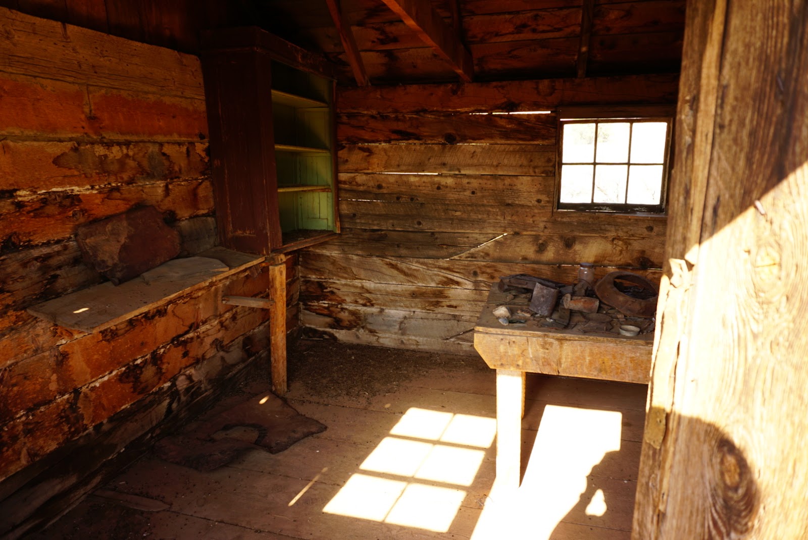
We pack up the next morning and head down switchbacks to the valley floor. First stop is at the Morrell Cabin, a simple relic of Utah's ranching heritage. The cabin was initially used as a lumber camp and then as a line camp for Cowboys moving cattle in the area. A lot of wildflowers still here!
 |
| Cross a creek bed to get to cabin. |
 |
| Pretty wildflowers |
 |
| What a great fixer upper we found! |
Got some closer pictures of the Temples of the Sun and Moon.
 |
| Driving through Cathedral Valley |
Look at these nearly vertical black dikes standing higher than the rock formations. These are from recent volcanic intrusions.
We took a spur road to the Gypsum Sinkhole. It is a big hole in the ground. Selenite, the mineral in gypsum, contributed to the sinkhole. The sinkhole is 200' deep and 50' across with sheer, overhanging walls. We were pretty impressed!
 |
| Looking up the sheer cliff above the sink hole. |
We now enter into the Lower Cathedral Valley. This is where the Temples of the Sun and Moon trail is. We continue on down the Caineville Road, which is pretty rough. The Caineville Wash crisscrosses it numerous times. Lots of different rock formations. The gray-black slopes are the Caineville Mesas composed of Mancos Shale. Finally, we make it back onto Hwy. 24 and civilization again.
Now lets talk fish! We took the trailer for 3 nights to Otter Creek State Park Reservoir and had a blast! We learned how to fish for rainbow trout from some locals. Took the canoe out on this beautiful lake and had fun catching our limit.
 |
| Otter Creek with mountains in the background. |
 |
| Campsites along the lake. |
 |
| Got the canoe ready to go! |
 |
| Proud of that one big one! |
We also drove out to Lower Bowns Reservoir which is about 40 minutes from Capitol Reef. Took about an hour and a half to catch our limit of rainbows. Talk about fun! Came back and had a fish dinner with our fellow co-hosts John and Trish.
 |
| Catch of the day! |
 |
| Prepped for the grill |
 |
| Done! |
And we ended our time with a little Texas BBQ'd ribs and visiting with our Ranger friends and neighbors.
 |
| Putting that brown sugar glaze on with the pear burner! |
 |
| Yummy ribs |