This post is all about Death
Valley National Park, located in the desert in California. I don’t know
about you, but when I think of Death Valley, it’s my childhood memories. Hot as hell. Mormons died in the 1800s
because the only water they found was salty and no one or no other animals
would drink. I remember watching western tv shows about it.
But…..if you come in the spring it’s a whole different story! We planned our launch date for this trip
around getting here in hopes of a super bloom or at least wildflowers. Well, sorry to say no super bloom. But there are many wildflowers to view.
 |
| Near Pannamint Canyon |
Here’s some history.
Death Valley National Park was established in 1994, the 53rd
park among America’s 59 National Parks.
It straddles eastern California and western Nevada. Death Valley is known for its colorful rocks
and Badwater Basin’s salt flats…which we hiked to. Badwater Basin is the lowest
place in North America at 282 feet below sea level. It’s record temperature is 134 degrees
Fahrenheit makes it the hottest place on earth.
Thank goodness we visited in the spring before it got so hot. The massive salt flat here covers nearly 200
square miles and lies more than two miles below the 11,331 foot Telescope Peak
that looms above it. Whew. But don’t
forget about the Mormons that traveled through here, couldn’t find water, and
well….you might remember the rest of that story!
So, Day 13, April 5 our destination is Death
Valley National Park. We logged 732
miles driving in Arizona. On our route
here, we travel into California, then Nevada close to Las Vegas, before
entering the park back through California.
We got hailed on south of Vegas.
Nothing big or bad. We got
settled into our site (#16) at Furnace Creek which is below sea level. We have views of snow capped mountains on one
side and views of black clouds in the valley and over the mountain on the other
side. It’s cool – upper 50’s (I know you
were expecting heat). It’s beautiful!
Not what we expected. We came in hopes of a super bloom but there’s just
beautiful patches of flowers.
 |
| Hail south of Vegas |
 |
View from campsite
 |
Day 14 – April 6
What a beautiful, peaceful place this is. Today it’s clear
blue skies. There are flowers – if you walk in the desert. We undocked and took
a ride to Badwater Basin that is 282’ below sea level. We made a side
drive through Artist Canyon which was well worth it. Then we took a long
hike to the Devil’s Golf Course. There’s still water in the lake, which
is amazing. The dried salt formations here looked like coral. So cool to see
this. BTW it’s not hot. We have on jeans
and long sleeves. We continued our drive which made a long loop back to Furnace
Creek. We saw beautiful cactus in bloom. Their hot pink flowers looked fake as
we were driving through.
 |
| The truck looks small! |
 |
| Really didn't expect to see so much snow here. |
 |
| Looking down at Badwater Basin |
 |
| Some twisting roads! |
 |
| Pretty patch of yellow daisies |
 |
| Worth the long hike down to really see and touch! |
 |
| Wading to the water |
 |
| These almost looked fake when you're viewing across the land. |
Day 15 – April 7, 2024
We’re starting week #3!
We did a drive on the northeast side of the park. We headed towards Stovepipe Wells Village
where the Mesquite Flat Sand Dunes are.
 |
| Mesquite Flat Sand Dunes |
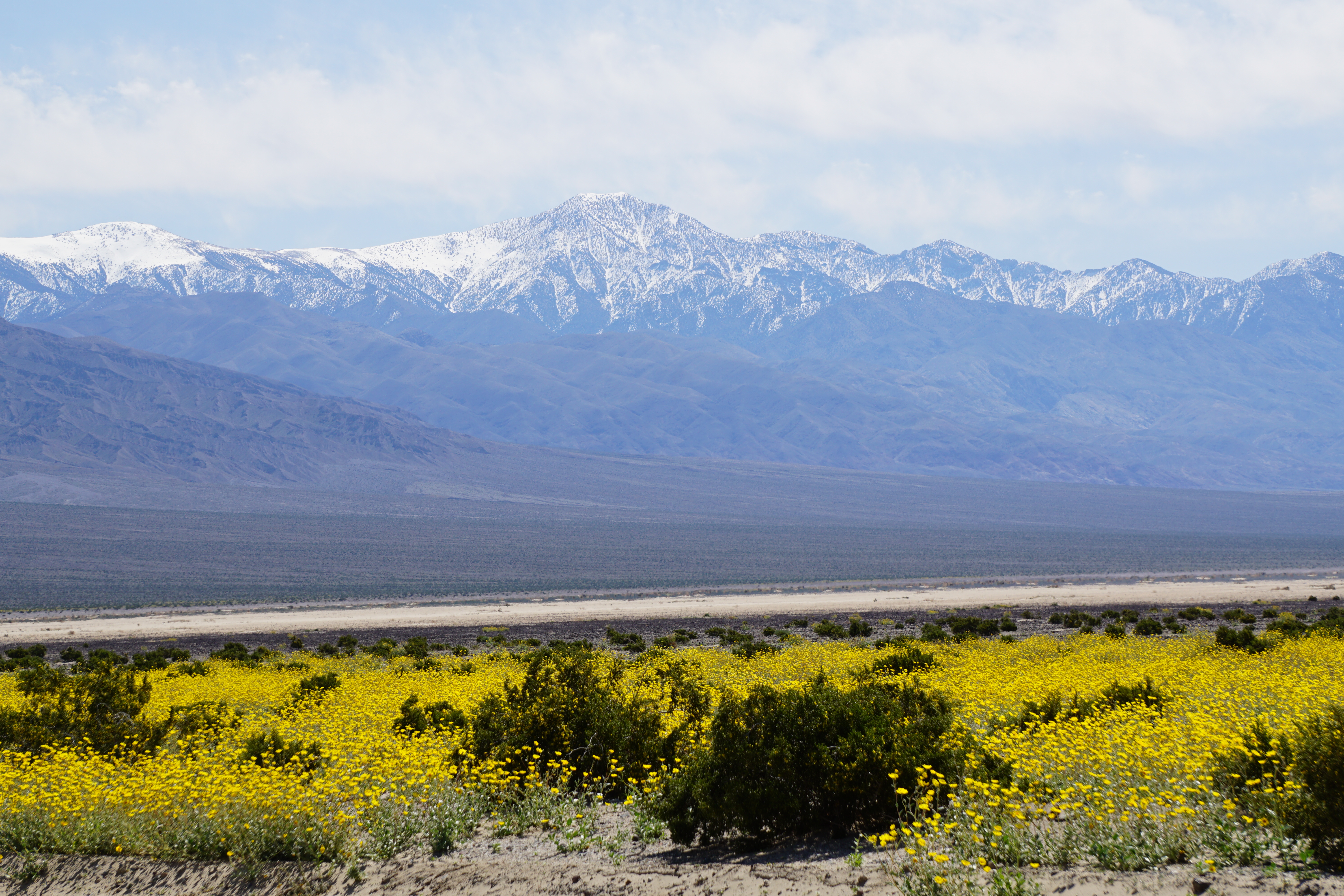
As we neared Panamint Springs Valley, you could see a
carpet or yellow daisies everywhere!
Very pretty!
 |
| Fields of yellow flowers |
 |
| Even taken through the windshield it's pretty |
We then drove up to Father Crowley Vista Point that
overlooks Rainbow Canyon. We didn’t realize that the Air Force does
drills through this valley and canyon.
 |
| Rainbow Canyon |
You know the song…..”The stars at night are big and bright,
deep in the Heart of Texas!” Well the stars here our just absolutely amazing.
We left the window open on the hatch above the bed just to continue watching
them. Billions of stars look like a pincushion stuffed with pins.
The weather is still good.
Came back and docked the truck and camper to be ready to leave tomorrow
for a state park in Nevada. Our
California driving miles totaled 520 miles, mostly just driving through this
enormous park.
Death Valley…….so empty, so vast, so simple, so quiet.


